ARIBIC (Artificial Intelligence-Based Indoor Cartography) is a recently completed research project that focused on collecting and utilizing data to create a digital twin of a warehouse. Hamburg-based intralogistics provider, STILL, plans to transform the insights gained from the project into marketable products. Interested individuals can learn more about the project at the Hannover Messe.
Table of Contents: What awaits you in this article
Real-time 3D maps optimize warehouse processes and enhance safety
The real-time 3D maps provide companies with a clear representation of their warehouse, contributing to the optimization of warehouse processes. These maps enable the localization of driverless and manual transport systems, as well as the optimization of travel routes and warehouse structures. Additionally, they allow for real-time inventory and automated material orders through integration with the inventory management system. Furthermore, they enhance warehouse safety by detecting defective infrastructures or blocked emergency exits in the 3D map.
ARIBIC Project: Real-time 3D Warehouse Mapping for Optimization
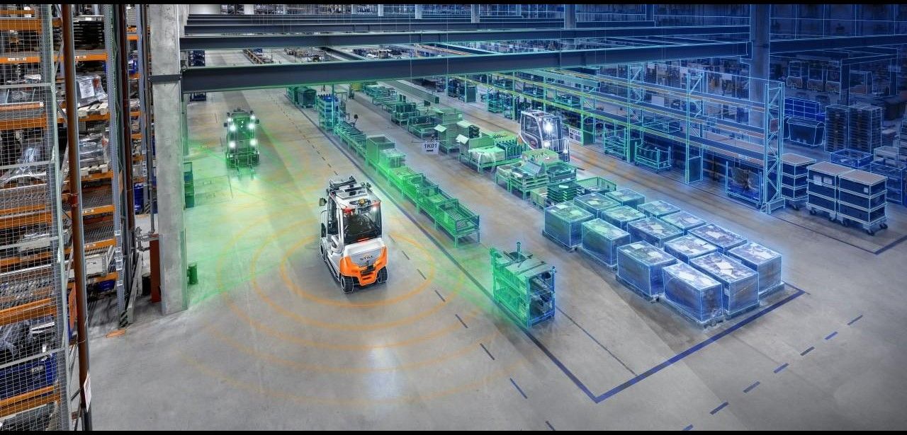
The ARIBIC project utilized a sensor setup in forklifts to collect data for the creation of a digital twin. This data was then combined to create a digital representation of the environment, which was transferred to the cloud and enriched with semantic information. The result is a dynamic, real-time 3D twin of the warehouse that updates in real-time based on the continuous movements of the forklifts.
ARIBIC project lays foundation for versatile digital applications in intralogistics
The ARIBIC project has laid a valuable foundation for versatile digital applications in the field of intralogistics and warehouse optimization. Over the next two years, the project results will be implemented in practical applications and integrated into commercial products. STILL is already planning to start implementing the research findings into practical products next year.
ARIBIC Project: Advancing Intralogistics with Real-time 3D Mapping
The ARIBIC project, funded by the German Federal Ministry for Economic Affairs and Energy (BMWi) and the Industrial Research Assistance Program of the Canadian National Research Council (NRC IRAP), ran from March 2021 to the end of 2023. It involved multiple organizations, including STILL, Karlsruhe Institute of Technology (KIT), University of Toronto with the STARS Lab, and Canadian sensor manufacturer LeddarTech. STILL contributed its autonomous picker OPX iGo neo, equipped with sensors and camera technology, to the project.
Real-time 3D maps revolutionize intralogistics: Benefits and applications
Real-time 3D maps provide numerous benefits for companies in the field of intralogistics. They offer transparent localization of transport systems, optimize routes and warehouse structures, enable real-time inventories and automated material ordering, and enhance warehouse security. The ARIBIC project has demonstrated that these advantages can be realized through automated data collection and the utilization of a digital twin. Over the next few years, the project’s findings will be implemented in practical applications and integrated into commercial products.


